The Project lies 1.6 kilometers west of the town of Contact, Nevada, and 5.5 kilometers east of Ellen D Mountain. It is located on the northern contact between the Jurassic batholith and the Paleozoic sediments. The Paleozoic sediments near this contact form an anticline with the south limb dipping steeply into the batholith and the other dipping gently away from the batholith. The contact between the intrusive and sediments dip between 45° and 60° North.
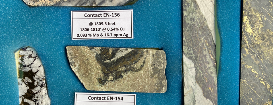
Paleozoic age sediments cap the ridges north of the intrusive and are of marine origin. The siliciclastic rocks range in grain size from clay to coarse-grained sand and have carbonate contents ranging from zero to greater than 50% of the rock. Altogether, approximately 762 meters of Permian to Mississippian sediments are exposed on the property. Mineralization in the sediments consists most notably of skarn replacement deposits. These deposits are generally hosted in silicified and garnetiferous limestone. The copper sulfide minerals, chalcopyrite and bornite, have partially replaced a percentage of the rock. In places, up to 20% of the rock has been replaced by copper sulfides; however, five percent is more commonly observed. Veins of quartz and metallic sulfides are also found in the sediments.
The principal resource area is best described as a mesothermal sheeted quartz and copper vein system trending ENE and dipping 45-60°S.
In the principal resource area, copper mineralization occurs as an intrusive-related deposit within the Contact batholith and is observed in quartz veins within structural zones and in the surrounding granodiorite. The copper content is highest in the quartz veins, particularly where chalcocite is present, but grades outward into granodiorite where copper minerals occur in quartz veinlets, fracture coatings, and disseminations. Mineralization is in the form of tenorite, chrysocolla and cuprite, and lesser chalcocite and covellite. Oxidation is observed at depths of 600 meters in drilling.

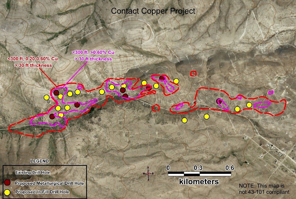
Over 86,000 meters were drilled at Contact Copper between 1967 and 2012. The previous operator drilled in excess of 55,000 meters between 2007 and 2012 establishing numerous NI 43-101 compliant resource estimates and the measured and indicated resources for the 2013 pre-feasibility study.
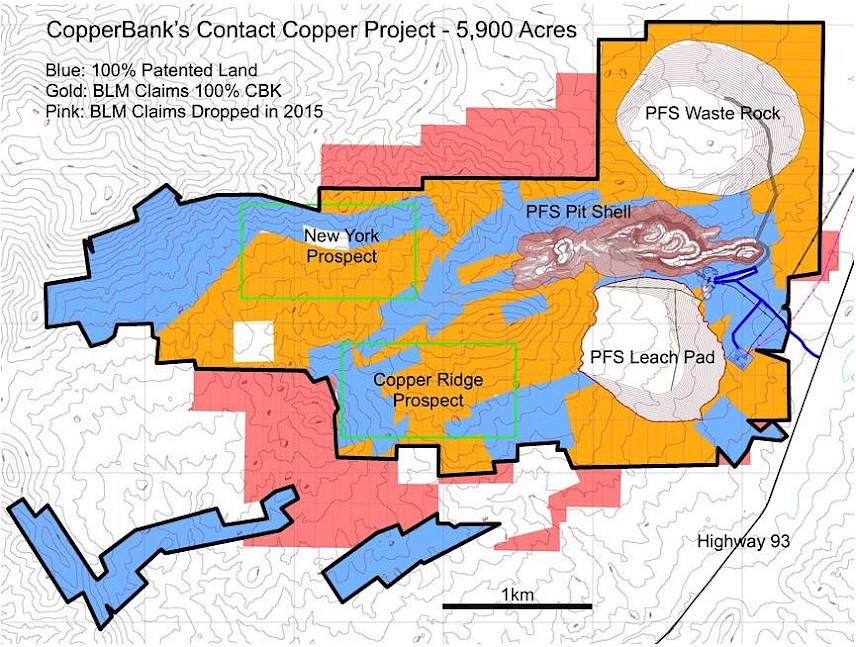
In 2011, land holdings at the project were increased through the acquisition of adjoining claims. Subsequently, surface sample coverage in the district was increased and additional geologic work was conducted. The two most significant zones of copper oxide mineralization were identified as the Copper Ridge and the New York prospects.
The Copper Ridge prospect is located 1.5 kilometers southwest of the project’s primary resource area. Copper mineralization is present in exposed gossans, silicified quartz veins and veinlets, and leached zones with iron oxides. The area extends approximately 2,400 meters east-west by 600 meters north-south. Previous activity is limited to shallow prospect pits and the area has no previous drilling. The results of the surface sampling program confirm the presence of copper across the area. Further geologic mapping and sampling are needed to identify drill targets.
The New York prospect is located 3.2 kilometers west of the project’s primary resource area on the southeast flank of Ellen D Mountain. Surface outcroppings of copper oxide minerals are present in zones of potassic alteration and silicification over an area approximately 760 meters by 76 meters in width that trends toward underground mine workings on Ellen D Mountain. The area has not been drill tested and requires additional mapping and sampling to identify drill targets.


